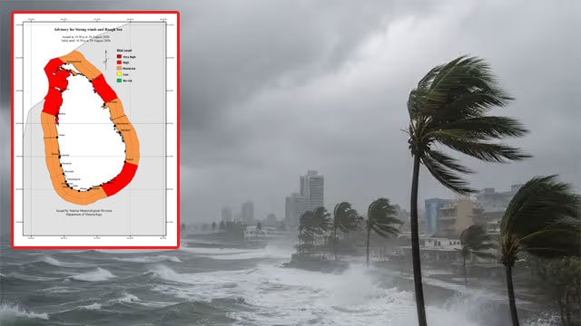
The Department of Meteorology has issued an “Amber” advisory for strong winds and rough seas covering northern and south-eastern waters, moving the warning zone away from the southern coast it flagged earlier this week.
The affected sea areas run from Kankesanthurai to Puttalam via Mannar, from Mullaitivu to Trincomalee, and from Hambantota to Pottuvil, Ada Derana reported. Those waters will be rough at times, with strong gusty winds of up to 50 to 60 kmph.
Wave heights may rise to about 2.0 to 3.0 metres off the coast from Puttalam to Pottuvil via Colombo, Galle and Matara. Naval and fishing communities have been advised to remain vigilant.
What has changed since Wednesday
The department’s Amber advisory on August 26 covered high waves from Colombo to Pottuvil via Galle, Matara and Hambantota — the southern arc only, with no northern waters named.
Friday’s advisory adds the entire northern sea belt: Kankesanthurai, Mannar, Mullaitivu and Trincomalee all appear for the first time in this run, and the wind warning now reaches down the west coast as far as Puttalam. The wave band has also widened westward, from Wednesday’s Colombo starting point to Puttalam.
The southern stretch from Hambantota to Pottuvil remains under warning in both.
What Amber means
The Meteorological Department’s colour-coded scale places Amber above a routine advisory but below Red, which is reserved for the most dangerous conditions. It signals conditions capable of disrupting small-boat operations and is a call for vigilance rather than a ban on going to sea.
The department did not state how long the advisory will remain in force. Marine conditions have been unsettled through August, with sea surface temperatures around the island up about 1°C amid El Niño.
No other verified Sri Lankan newsroom had filed its own report on Friday’s advisory as of mid-morning; the Daily Mirror breaking listing carried no equivalent item.