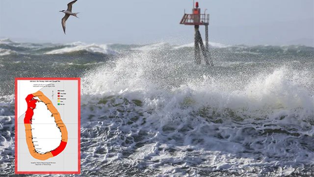
The Department of Meteorology has issued an “Amber” advisory for strong winds and rough seas covering waters from Kankesanturai to Puttalam via Mannar, and from Hambantota to Pottuvil.
Those sea areas will be rough at times, with strong gusty winds reaching 50 to 60 kmph, Ada Derana reported. Wave heights may rise to about 2.0 to 2.5 metres off the coast from Puttalam to Pottuvil via Colombo, Galle and Matara. Naval and fishing communities have been asked to remain vigilant.
What has changed since Friday
The advisory is a narrowing of the one issued a day earlier. Friday’s warning covered three stretches; Saturday’s covers two.
- Dropped: the Mullaitivu to Trincomalee belt, which appeared in Friday’s advisory but is absent from Saturday’s. The north-eastern coast is no longer under the wind warning.
- Eased: the wave ceiling has come down from 2.0–3.0 metres to 2.0–2.5 metres, a half-metre reduction across the same Puttalam-to-Pottuvil arc.
- Unchanged: the 50–60 kmph wind band, the Kankesanturai–Puttalam stretch via Mannar, the Hambantota–Pottuvil stretch, and the geography of the wave zone.
Friday’s advisory had itself been an expansion, adding the entire northern sea belt to a warning that on Wednesday covered only the southern arc from Colombo to Pottuvil. The pattern over three days is a northern system that widened sharply and has now begun to retreat from the east.
What Amber means
The department’s colour-coded scale places Amber above a routine advisory but below Red, which is reserved for the most dangerous conditions. It signals conditions capable of disrupting small-boat operations and calls for vigilance rather than a ban on going to sea.
The department did not say how long the advisory will remain in force. Marine conditions have been unsettled through August, with sea surface temperatures around the island up about 1°C amid El Niño.