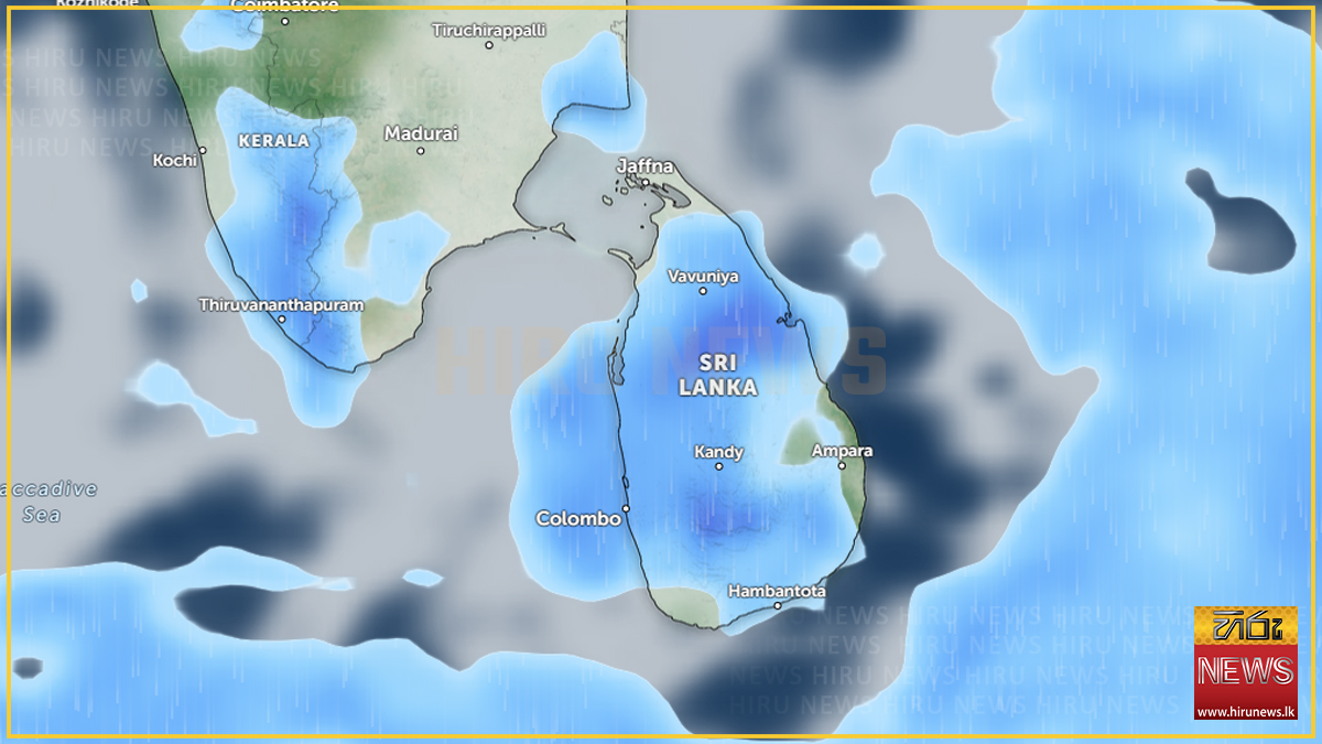
Heavy showers of about 100 mm are likely at some places in six provinces on Tuesday, the Department of Meteorology says, with showery conditions expected to strengthen across the island from the evening.
The six are the Northern, North-central, Central, Eastern, North-western and Uva provinces. The forecast was issued at 5.30 a.m. on 20 October and attributes the change to “the development of an atmospheric disturbance in the lower atmosphere in the vicinity of Sri Lanka.”
Rain may fall in the Northern and North-western provinces during the morning. Showers or thundershowers will occur in most parts of the island after 1.00 p.m. Misty conditions can be expected early in the morning at some places in the Western, Sabaragamuwa, Central and Uva provinces.
The department repeated its standard warning, asking the public to take adequate precautions against the temporary localised strong winds and lightning that accompany thundershowers.
The threshold has risen and the map has flipped
Monday’s forecast and Tuesday’s are not variations on one advisory. They point at different halves of the country.
On 19 October the department forecast “fairly heavy showers above 75 mm”, and the areas it named were led by the Western province. On 20 October it forecasts “heavy showers about 100 mm”, and the Western and Sabaragamuwa provinces have dropped out of the heavy-rain list entirely — they now appear only in the early-morning mist line. The heavy rain has moved to the north, the east and the centre.
The wording matters as much as the number. “Above 75 mm” is a floor; “about 100 mm” is an estimate. A reader comparing the two days should not read the change as a straightforward escalation at a fixed location.
Yesterday’s split list has closed
This desk flagged on Monday that the forecast named four provinces and then four districts separately, so that Kurunegala, Polonnaruwa, Trincomalee and Mullaitivu were each covered without their provinces being listed — and a reader who read only the province line would have missed them.
Tuesday’s forecast is province-only. There is no district line, and the four provinces those districts belong to — North-western, North-central, Eastern and Northern — are all now named in full. The two-line hazard does not apply today.
A cause has been restored
Monday’s release carried no causal attribution at all. Tuesday’s names one: a disturbance in the lower atmosphere “in the vicinity of Sri Lanka.”
That is not the same attribution the department used earlier this month. Between 11 and 14 October it cited a low-level disturbance in the Bay of Bengal near Sri Lanka; on 15 October it attributed continuing rain to changes in the prevailing wind pattern. Tuesday’s wording places the disturbance near the island and does not mention the Bay of Bengal.
A wet spell that has already caused damage
The rain continues a sustained wet period. A landslide at Haputale and rising water in the Kirindi Oya were reported on 18 October, a rockfall struck a bus at Kadugannawa on 17 October, and health authorities have linked a rise in dengue cases to the weather.
Not reported
Neither filing gives a sea-area advisory or wind speeds for Tuesday, and neither says how long the disturbance is expected to persist. No severe-lightning advisory with its own issue and expiry times is reported for Tuesday — only the general precaution printed on every forecast.
A note on sourcing and a date trap
Hiru News filed in Sinhala at 7.31 a.m.; The Island reproduces the department’s English-language release in full, which is the source of the 5.30 a.m. issue time and the department’s exact wording quoted above.
One caution for anyone searching this story. The Island publishes the Met release most days under a headline generated from that day’s province list, with no date in the URL and no machine-readable publication date. The result is a very large family of near-identical headlines spanning years. A search for Tuesday’s province list returns at least ten “showers above/about 100 mm are likely at some places in the …” pages, none of them this one; one of the closest matches is the forecast for 10 December 2025. The page cited here was confirmed by fetching it and reading the forecast date in its own body.