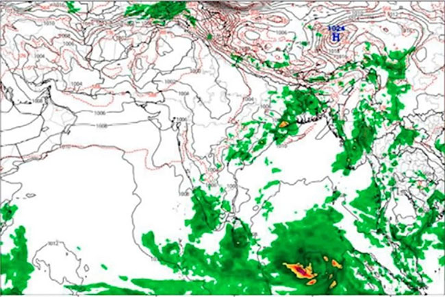
The Department of Meteorology says a low-level atmospheric disturbance in the vicinity of Sri Lanka is likely to develop into a low-pressure area on May 11 itself, with showery conditions expected to persist for several days.
The department said cloudy skies would prevail over most parts of the island. Showers or thundershowers will occur at most places after 1pm, and heavy rainfall above 100mm is likely at some locations. Morning showers are also forecast in the Western, Southern, Eastern and Northern provinces.
The Met Department asked the public to take adequate precautions to minimise damage from temporary localised strong winds and lightning during thundershowers.
Meteorologist Malith Fernando, speaking at a media briefing held by the Department of Government Information on May 10, said a significant increase in rainfall was expected across the country over the next few days. The prevailing pattern was not yet a full monsoon situation but rather a pre-monsoon condition, he said, adding that with the development of the low-pressure system, southwest monsoon conditions are likely to establish by around May 20.
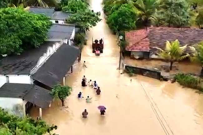
The advisory comes as Sri Lanka is already contending with heavy pre-monsoonal rains. On Saturday morning the Irrigation Department opened spill gates at the Deduru Oya, Lunugamvehera and Rajanganaya reservoirs as inflows climbed sharply, with the Met Department issuing rainfall and lightning amber alerts for several provinces. A developing low-pressure system in the Bay of Bengal vicinity typically intensifies showery activity over the island and increases inflows into already-filling reservoirs.
The May 20 onset would be slightly ahead of Sri Lanka’s traditional southwest monsoon timing of late May. An earlier-than-usual low-pressure formation could compound flooding risks in low-lying areas of the wet zone if rainfall persists at current intensities.
Update — May 12: The low-pressure system located northeast of Sri Lanka has persisted, the Met Department said. Heavy falls above 100mm are now likely in some places in the Western, Sabaragamuwa, Southern, Northwestern and Northern provinces and in the Trincomalee district on Tuesday (12), with rainy conditions expected to continue for the next few days. Wind speed over the sea areas around the island will increase, with winds gusting up to 50 kmph at times in the sea areas off the coast from Galle to Hambantota via Matara, where seas can become rough. The public was urged to take precautions against localised strong winds and lightning during thundershowers.
Related: spill gates opened at three reservoirs and heavy rainfall above 100mm forecast.
Sources: Ada Derana · The Island · Newswire.