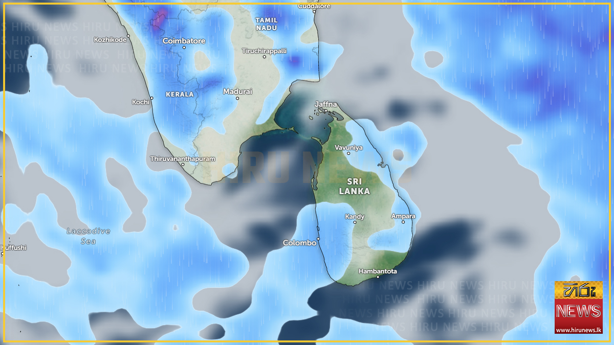
Rainy conditions over the south-western half of the island are expected to increase from Saturday, 19 September, the Department of Meteorology said, according to Hiru News.
Showers will occur at times in the Western, Sabaragamuwa and North-Western provinces and in the Galle, Matara, Kandy and Nuwara Eliya districts.
Fairly heavy falls of about 75 millimetres are likely at some places in Sabaragamuwa province and in the Kandy and Nuwara Eliya districts — enough to matter on the hill-country road network and for the catchments above the central reservoirs.
The department also expects showers or thundershowers after 2.00 p.m. in the Uva province, which it notes had previously been experiencing dry weather, and in the Mullaittivu, Batticaloa and Ampara districts.
The same system, two days running
The forecast follows a severe lightning advisory issued at 11.00 a.m. on Friday by the Natural Hazards Early Warning Centre, the Daily Mirror reported. That advisory warned of thundershowers with severe lightning at several places in the Uva and Eastern provinces and the Mullaittivu and Polonnaruwa districts, and expired at 11.30 p.m. the same day.
Neither outlet connects the two filings, but they overlap: Uva and Mullaittivu appear in both, and Batticaloa and Ampara are Eastern Province districts. The pattern is of convective activity that built over the east and Uva on Friday, with the Met Department now expecting the wetter conditions to extend across the south-west from Saturday.
The return of rain to Uva is the more consequential half. The department’s own wording marks it as a break in a dry spell there — relevant to a province that sits inside the drought-affected district counts reported this month.
Saturday also falls inside the ten-day window the department flagged on 16 September, when officials warned of widespread rain, landslides and floods under El Niño conditions and said October and November would be heavier still. Friday’s advisory and Saturday’s forecast are the first daily filings to land inside that window.
Standing lightning precautions
The advice issued with Friday’s advisory applies to any thunderstorm. The department urged the public to:
- seek shelter, preferably indoors, and not shelter under trees
- avoid open areas including paddy fields, tea plantations and open water
- avoid using wired telephones and appliances plugged into power outlets
- avoid travelling in open vehicles such as bicycles, tractors and boats
- watch for fallen trees and power lines after storms pass
Temporary localised strong winds may accompany thundershowers.
Not reported
Neither account gives the expected duration of the wetter spell, says whether any reservoir or river basin is being watched, or carries a warning from the Disaster Management Centre or the Irrigation Department. Friday’s advisory has lapsed and no successor advisory had been issued for Saturday at the time of writing.