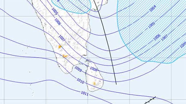
Sri Lanka could face increased rainfall and possible flooding in parts of the country during October and November as the developing El Niño climate phenomenon intensifies, the Department of Meteorology said today.
Director of Forecasting Ajith Wijemanna said current El Niño conditions remain at a weak level but are expected to strengthen in the coming months. He cited the US National Oceanic and Atmospheric Administration (NOAA), which has placed the probability of El Niño strengthening into a strong or very strong event between December and February at greater than 60 percent.
In the near term, Sri Lanka is likely to experience below-average rainfall during July, August and September, with rising temperatures particularly in August and a relatively dry September. Wijemanna cautioned that the outlook could shift if typhoons develop over the Pacific Ocean, which can enhance the southwest monsoon and bring additional rain to the island.
The strengthening El Niño could then drive above-normal rainfall in October and November, raising flood risk in certain areas. The southwest monsoon is expected to weaken under El Niño conditions, while the northeast monsoon is forecast to bring heavier rain to the Northern and Eastern Provinces, with possible flooding depending on other weather factors.
The Met Department has urged the public to follow weather advisories and forecasts issued regularly.
The forecast layers a flood risk on top of the 82 percent drought probability the Met Department earlier flagged for July and August, and follows NOAA’s mid-week confirmation that El Niño has officially begun with a 63 percent chance of reaching super El Niño intensity. The President has already convened a high-level El Niño preparedness meeting covering agriculture, water and power.
Update — June 14: Climate Change Secretariat offers more reassuring assessment
The Director of the Climate Change Secretariat, Leel Randeni, said Sri Lanka is unlikely to experience a severe impact from the developing El Niño, framing the outlook more conservatively than the Met Department warning earlier in the day. Speaking in remarks reported by Ada Derana and Newswire on Sunday, Randeni said the island’s geography — a mountainous central highland surrounded by the Indian Ocean — moderates extreme climatic effects, while the Indian Ocean Dipole influences evaporation and cloud formation in ways that contribute to local rainfall patterns. “As Sri Lanka is an island country with a central mountainous region, there is no significant possibility of moisture depletion. Therefore, we do not expect a major reduction in rainfall or a severe El Niño impact,” he said.
Randeni said Southwest Monsoon rains are expected to continue through September with intermittent rainfall during July and August, followed by the Second Inter-Monsoon in October and November and the Northeast Monsoon from December to February — the main contributor to annual rainfall. He said any pronounced El Niño impact would most likely be felt on the Northeast Monsoon rather than other rainfall seasons, and that temperatures could rise in February and March 2027 if the event intensifies. Despite the relatively reassuring framing, he urged efficient water management and preparedness for possible agricultural effects such as reduced crop yields and lower paddy production.
Update — June 16: Pacific NINO 3.4 temperature climbs to 0.92°C
The sea surface temperature in the central Pacific Ocean’s NINO 3.4 region rose to 0.92 degrees Celsius on Tuesday, up from 0.81 degrees the previous week, NewsFirst reported. Meteorologists say the continued rise indicates that El Niño conditions are strengthening rapidly across the Pacific Ocean, in line with the NOAA outlook the Department of Meteorology referenced earlier in the week.
Update — June 16: PM Harini names food, water and energy as preparedness priorities
Prime Minister Dr. Harini Amarasuriya said special attention must be directed at food security, water management and energy management in preparation for the anticipated impacts of El Niño, Ada Derana reported. Speaking at the Colombo District Coordinating Committee meeting at the Colombo District Secretariat on Tuesday, she also urged stepped-up awareness programmes on energy conservation and efficient use, citing both the direct domestic impact of the developing weather pattern and the global supply challenges expected to follow it.
The meeting also reviewed progress on the Decentralized Budget Programme, Rural Roads Programme, Disaster Risk Reduction Projects and the Prajashakthi Programme as of June 15, and approved the creation of a Sports Sub-Committee for the Colombo District. The PM’s remarks mark the first executive-level framing of the El Niño response as a three-pillar food–water–energy agenda. A separate Ada Derana wire on the same meeting added that she also urged stronger services such as day-care centres and vocational training for persons with disabilities under the Prajashakthi Programme.
Update — June 18: Pattiaratchi sees 100mm+ October–November; BoM warns Pacific could reach 3.3°C above average
Winthrop Professor of coastal oceanography Charitha Pattiaratchi of the University of Western Australia forecast that Sri Lanka could record rainfall exceeding 100 millimetres in both October and November on the back of the strengthening El Niño and an evolving Indian Ocean Dipole, NewsFirst reported. He said the developing strong El Niño event, coupled with a weak positive phase of the Indian Ocean Dipole, would shape the island’s rainfall through the coming months: rainfall is likely to decrease from this month through September during the Southwest Monsoon, then run above normal through October and November, before returning to below-average from January through April 2027. The 100-millimetre threshold for October–November is significantly above normal seasonal levels and aligns with the Met Department’s earlier flood-risk warning.
The Australian Bureau of Meteorology has separately revised its El Niño outlook based on data collected on June 14, NewsFirst added. Pacific Ocean sea surface temperatures in the central NINO 3.4 region had risen to 0.92°C above average by last Sunday — confirming the NewsFirst June 16 update — and BoM now indicates that the El Niño event may become stronger than previously projected, with central Pacific temperatures potentially rising by as much as 3.3°C above average by November. Indian Ocean temperatures remain within the neutral range but have been climbing over the past two weeks. The BoM revision shifts the upper bound of El Niño intensity above the earlier NOAA “super El Niño” framing and reinforces the agriculture and water management warnings already issued by the Climate Change Secretariat.
Update — June 19: PM Harini to appoint special committee on El Niño impact
Prime Minister Dr. Harini Amarasuriya said steps will be taken to appoint a special committee tasked with preparing the necessary plans to address the impact of El Niño, NewsFirst reported. Speaking on Sirasa TV’s “Muhunata Muhuna” programme on Wednesday night, the Prime Minister said a national programme has already been launched under the leadership of the President to respond to the weather changes expected from the developing El Niño event, and that instructions have been issued to all districts to ensure food security, energy management and water management. Discussions are ongoing at district committee level to decide on the necessary measures, she added.
The committee marks the first dedicated national mechanism announced for the response and formalises the food–water–energy framing the Prime Minister first outlined at the Colombo District Coordinating Committee meeting on June 16.
Source: Special Committee To Be Appointed To Address El Niño Impact – PM — NewsFirst, June 19.